Weekly Weather shows the week ahead for where you are and for the places you save. It started as a simple seven-day forecast; 4.0 turned it into one card you swipe through, from the weather now to tonight’s sky, with a map for rain, wind and dark skies. It’s free and open source, with no accounts and no ads.
The weather card
One card, four pages, and the rows below the card follow it. Tap an hour, or drag along a row, and the card moves through the hours with you.
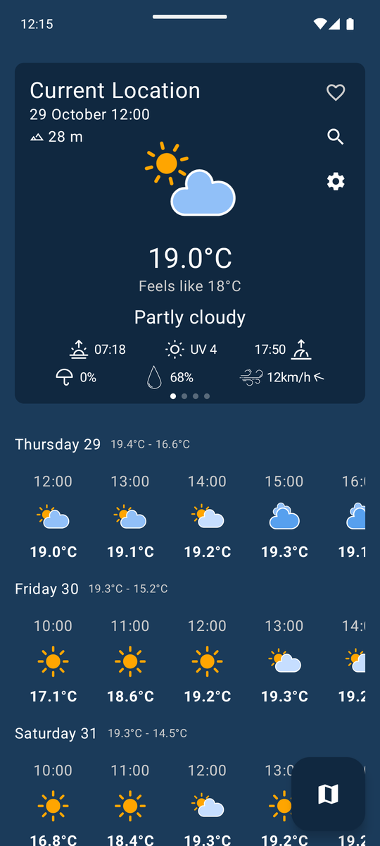
- Now: the temperature and feels-like, rain chance, humidity and wind, sunrise and sunset, the place’s altitude, and a strip of the rain in the next two hours. Below, every day’s hours.
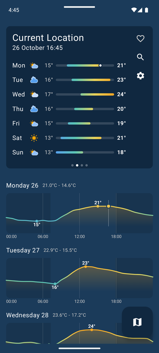
- Week: every day’s high and low as bars on one shared scale, so a warm day stands out from a cold one, and each day’s temperature drawn hour by hour.
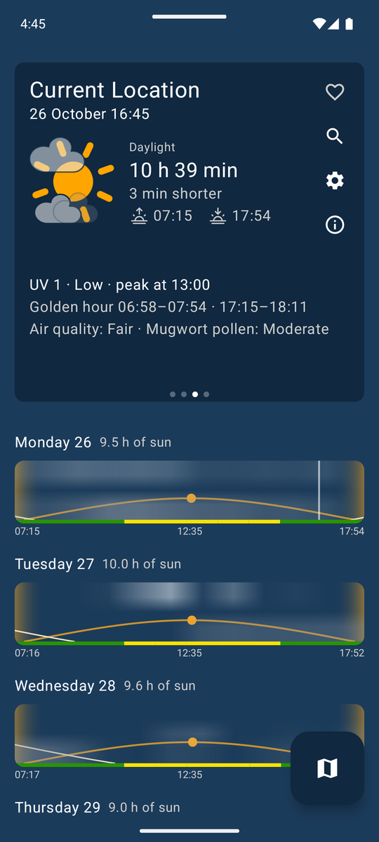
- Day: a big sun with the cloud over it, the day’s length and how it’s changing, the UV peak, the golden hours, air quality and the strongest pollen. Each day’s row draws the sun’s path across the sky, the golden hours at both ends, and the cloud at three heights: low cloud hides the sun, high cloud only veils it.
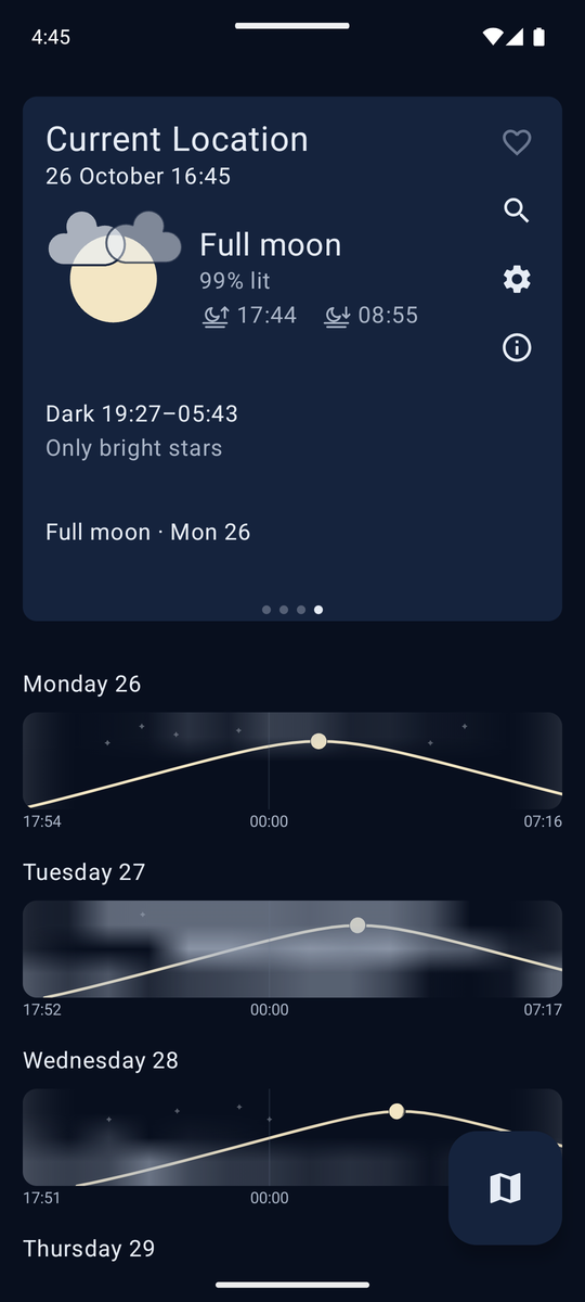
- Night: the moon in tonight’s phase, lit from the right side for your place and hour, with moonrise and moonset, the dark hours, and what the sky will show: the Milky Way, only bright stars, or none. Each night’s row runs from sunset to sunrise, with the moon’s arc, the twilight, and stars that fade as the moon rises, the cloud rolls in or the city’s glow takes over.
The Day and Night pages each have a key that explains how their drawings work.
Places from other apps
Share a place from Google Maps, Organic Maps or CoMaps to Weekly Weather, or open a location link with it, and its forecast opens. Organic Maps, CoMaps and a dropped pin in Google Maps share the exact point. A named place in Google Maps only shares its name, so the app looks it up and opens it when the search clearly finds it, or leaves the search open with the name filled in. The forecast and the map always show the same place, wherever it came from.
The map
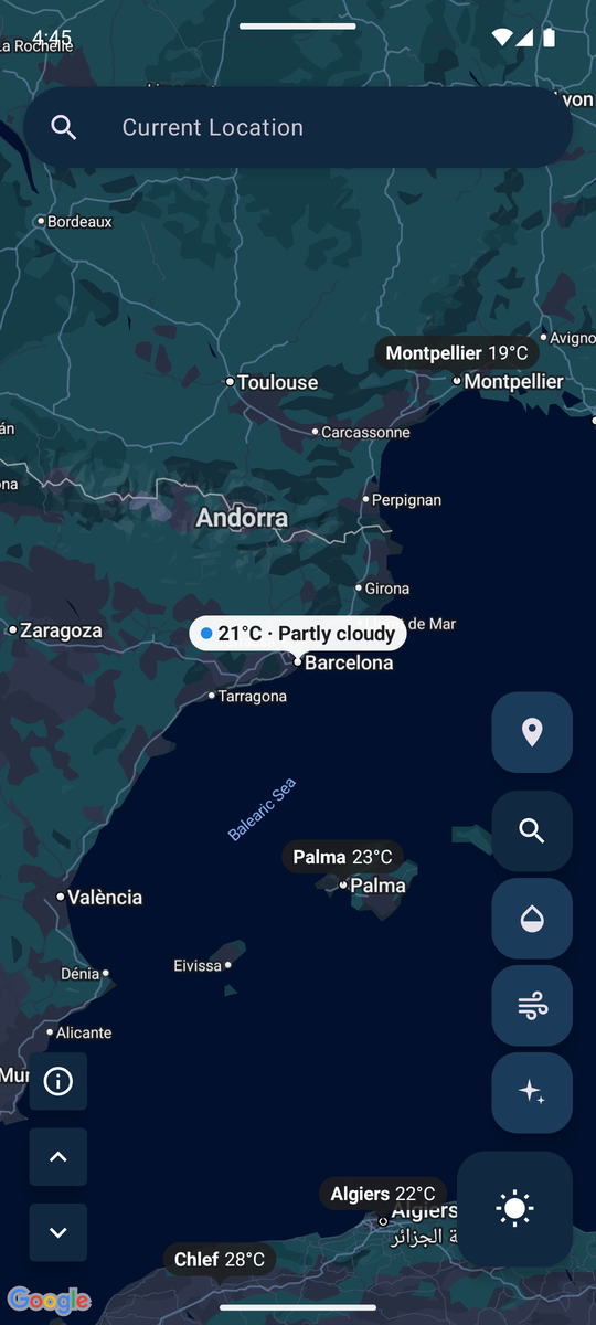
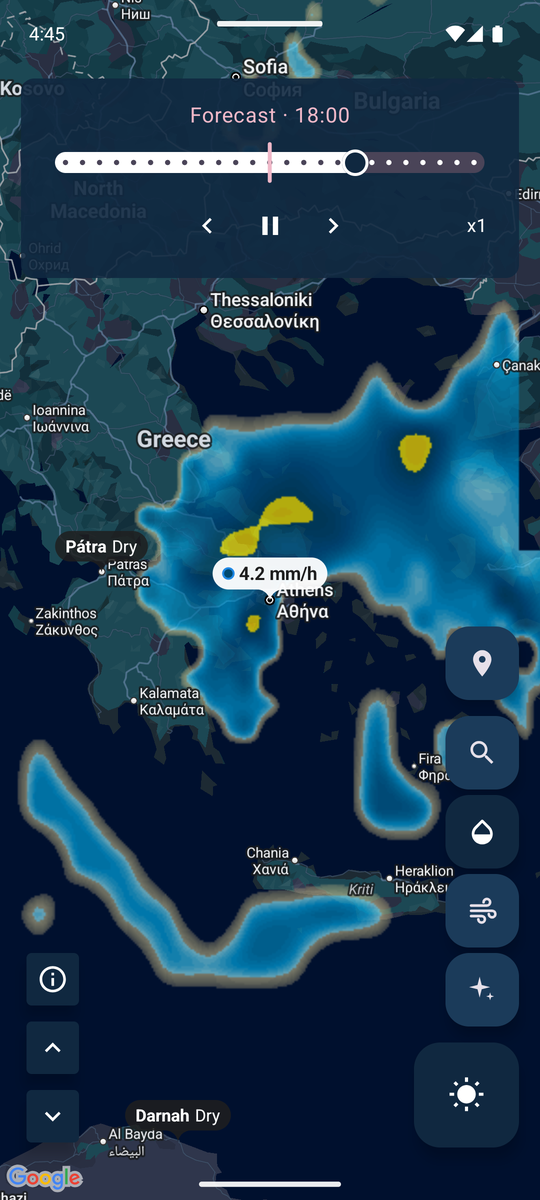
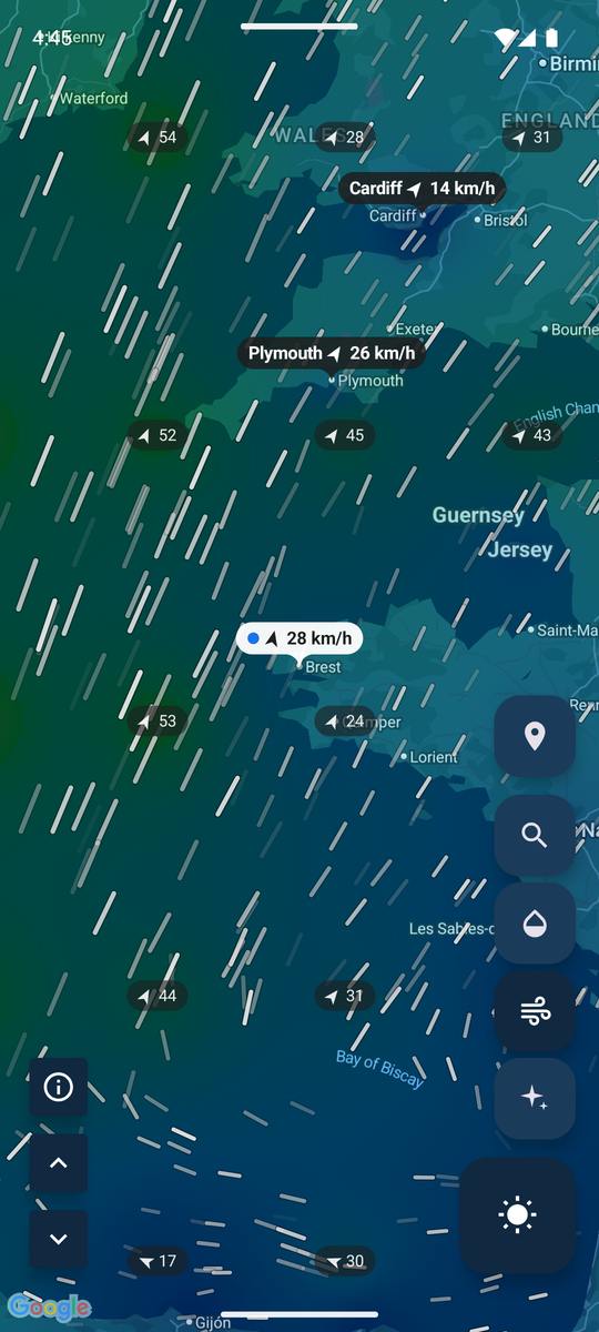
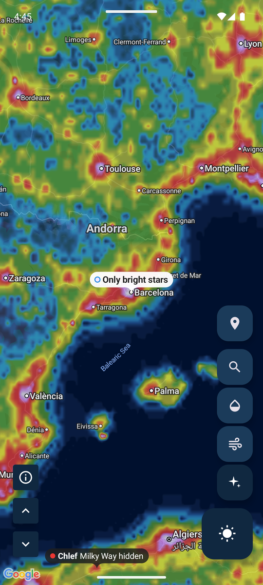
Every layer labels the place you’re looking at and the main cities around it with what that layer shows there, and a long press anywhere opens that place’s weather.
- Weather: the temperature and sky now.
- Rain radar: the last hours of RainViewer’s radar, then six hours of forecast rain, with play, pause and a time slider.
- Wind: animated particles that follow the wind over a wind-speed heatmap.
- Light pollution: how bright the night sky is, from a city’s glow to a pristine sky, from the World Atlas of Artificial Night Sky Brightness.
How it’s built
Weekly Weather is a multi-module Kotlin and Jetpack Compose app: MVI with a pure-function state reducer per screen, Koin, Room, Retrofit and Moshi, and separate modules for the weather, map, search and settings features and the shared core.
- Free weather, used carefully. All the weather comes from Open-Meteo’s free API, which has per-minute, hourly and daily limits. The forecast, the map’s layers and the search share one request budget, forecasts are cached per place, and a request only counts once Open-Meteo has answered, so an hour offline doesn’t use it up.
- An adaptive rain grid. The forecast rain on the map is fetched on a grid as coarse as the view is large, refined twice as fine only where it rains, and again where the finer grid found detail the coarser one missed. Detail is only spent where it rains, and a whole continent costs about as many requests as a city.
- The sky, on the phone. Sunrise and sunset come with the forecast, but the moon, its phase and the angle of its lit side, the dark hours, the golden hours and the sun’s path are worked out on the phone with Astronomy Engine, with the polar day and night and the clock changes handled.
- A light pollution atlas in 4 MB. The world’s night-sky brightness is packed into the app as four bits a cell, so the map layer and the night rows need no network at all.
- 35 languages, with every string, key and explanation translated.
Privacy
Your location goes only to the services that show its weather and map: Open-Meteo, RainViewer and Google Maps. Anonymous usage statistics (Umami) and crash reports (GlitchTip) both run on my own servers, and neither ever includes your location, the places you look up or what you search for. The privacy policy has the details.
Credits
Weather, air quality, wind and altitude data from Open-Meteo (CC BY 4.0), air quality and pollen from the Copernicus Atmosphere Monitoring Service, radar from RainViewer, city names from GeoNames (CC BY 4.0), weather icons from Makin-Things/weather-icons (MIT), sky positions from Astronomy Engine (MIT), and light pollution from the World Atlas of Artificial Night Sky Brightness (Falchi et al. 2016, CC BY-NC 4.0).
Latest version: 4.1 (2026).